
Imelda Weakens to Extratropical Cyclone, Coastal Flood Warning in Effect for North Carolina
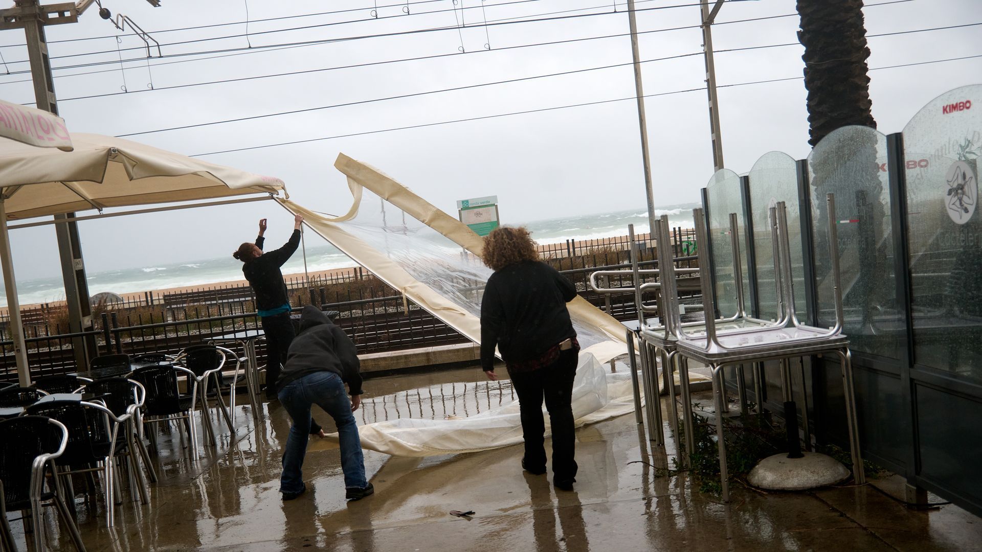
As of 11 a.m. on Thursday, October 2nd, Imelda has weakened from a hurricane to an extratropical cyclone. While located east of Bermuda, its swells continue to impact the North Carolina coast, raising concerns about ocean overwash and coastal flooding.
Imelda's Impact on North Carolina
Despite being downgraded, Imelda's swells are still reaching the North Carolina coast. This is leading to concerns about ocean overwash, particularly along portions of the Outer Banks.
A coastal flood warning is currently in effect until 8 p.m. on Friday, October 3rd for areas including east Carteret County, Ocracoke Island, and Hatteras Island.
Additionally, a coastal flood advisory has been issued. This advisory remains in place until 8 p.m. Friday, October 3rd for the northern Outer Banks. It also affects low-lying areas near shorelines and tidal waterways in west Carteret and coastal Onslow counties until 8 p.m. Thursday. Furthermore, it is in effect until 8 a.m. Friday for low-lying areas near shorelines and tidal waterways in Pamlico, southern Craven, and Beaufort counties.
Beachgoers should exercise caution due to high surf and large breaking waves expected in the surf zone. These conditions are expected to persist at least until tonight, or through Saturday, October 4th in some areas. There is also a high or moderate risk of rip currents across the North Carolina coast.
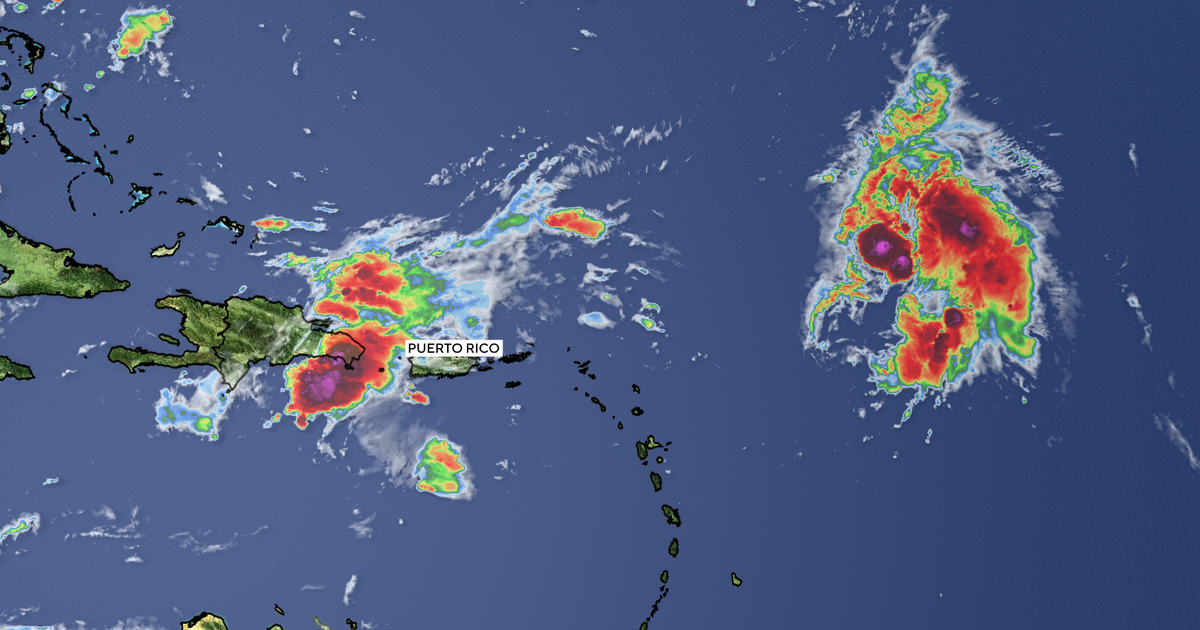
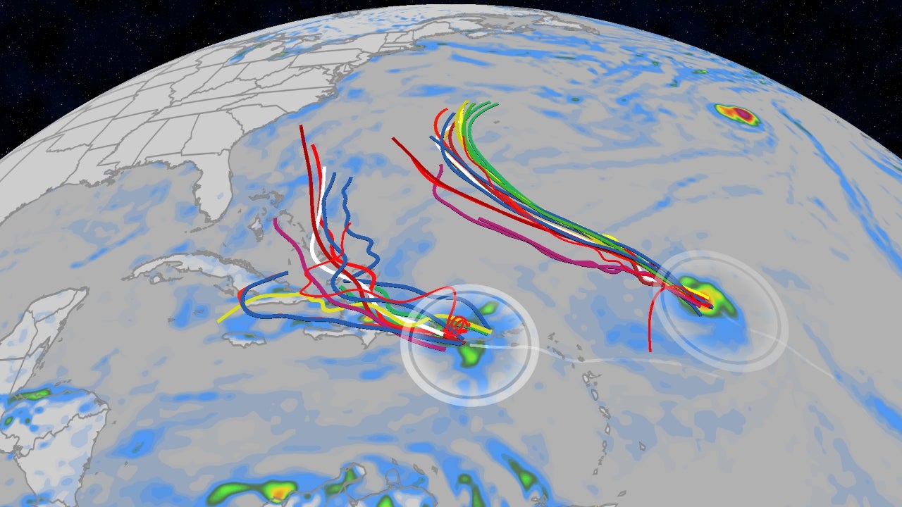
Other Atlantic Disturbances
The National Hurricane Center is also monitoring two other disturbances in the Atlantic, both with low chances of developing significantly over the next seven days as of Thursday, October 2nd.
- An area of low pressure may form near the northwestern Bahamas and southern Florida. Development is expected to be slow as it moves across the Florida peninsula and into the Gulf of Mexico. The chance of formation is 10% through both 48 hours and seven days.
- Off the coast of Africa, a tropical wave is expected to interact with another disturbance in the eastern tropical Atlantic. Some slow development is possible as the combined feature moves west. The chance of formation through seven days is 20%.
Looking Ahead
Hurricane season continues through November 30th. The next named storm will be Jerry. The National Hurricane Center will continue to monitor these disturbances and provide updates as necessary.
Connect with the North Carolina Service Journalism Team
Have questions about life in North Carolina? Want to share a tip or story idea? The service journalism teams at The News & Observer and The Charlotte Observer are eager to hear from you. Submit your question through the provided form.